%20--%3e%3cdefs%3e%3cstyle%3e%20.st0%20{%20fill:%20%231d1d1b;%20}%20%3c/style%3e%3c/defs%3e%3cpath%20class='st0'%20d='M174.5,69.9c-2.1-4.9-5.6-10.7-10.4-17.3-4.9-6.6-11-13.3-18.2-20-8.3-8.3-17.9-14.7-28.8-19-10.9-4.4-21.9-6.6-33-6.6s-23.7,2.7-33,8.1c-6.4,4.4-11.6,10.3-15.1,17.7-3.7,7.3-5.4,15.2-5.4,23.6,0,32.9,22.7,53.8,68,62.6,35.6,7,60.4,17.4,74.7,31.3,14.2,13.9,20.5,32.9,18.7,57-1.3,25.5-10.7,44.2-28.2,56.3-17.4,12.2-38.5,18.4-62.8,18.7-20-.2-38.3-3-55.2-8.1-16.9-5.2-31.2-12.6-43.1-22.1l-1.1-67.7c7.2,22.8,19.5,42,36.8,57.6,17.2,15.6,36.3,25.6,57.3,29.9,7.6,1.6,14.8,2.3,21.8,2.3,17.1,0,31.1-4.2,42.2-12.7,11-8.4,16.6-21.2,16.6-38.3s-6.4-30.7-19.5-43c-13-12.3-36.5-22.2-70.4-29.8-29.3-6.4-49.3-16.2-60.1-29.3-10.8-13.1-15.9-29.1-15.3-48,.2-14,4.2-26.3,12-37.1s18.4-19.2,31.9-25.2c13.4-6.1,28.8-9.1,45.9-9.1s28.2,1.9,41,5.7c12.8,3.8,23.7,8.3,32.5,13.8l.8,49h-.3Z'/%3e%3cpath%20class='st0'%20d='M269.3,250c0,11.1,3.7,18.4,10.9,22,7.2,3.4,14,5.2,20.2,5.2h-90.2c6.2,0,12.9-1.8,20-5.2,7.1-3.4,10.7-10.8,10.7-22V32.1c0-11.1-3.4-18.4-10.4-22-7-3.4-13.8-5.2-20.2-5.2h90.2c-6.4,0-13.3,1.8-20.5,5.2s-10.7,10.8-10.7,22v217.7h0ZM403.9,236.7c8.8,11.4,17.7,20.5,26.7,27.2,8.9,6.8,16.8,11.2,23.6,13.6l-53.7-.8c-9.1-8.3-18.2-18.6-27.6-30.7l-73.1-94.9c-2.3-3.1-5.3-4.7-8.9-4.7-6,0-12.4,3.7-19.5,10.9l90.6-108.5c5.7-6.8,8.6-13.4,8.6-20.2s-2-11.1-6-15.3-9.2-6.9-15.8-8h80.5c-2.3,0-7.6,1.7-15.8,5-8.1,3.3-17.7,9.9-28.6,19.5-4.9,4.4-13.1,13.6-24.7,27.6-11.6,14-21.6,26.3-30.1,36.9l-6.2,7.8c-5.7,5.7-8.6,11.1-8.6,16.3s1.9,8.4,5.8,13.6l82.8,104.6v.2Z'/%3e%3cpath%20class='st0'%20d='M516.2,248.4c0,11.7,3.7,19.3,11.1,23.1,7.3,3.8,14.3,5.7,20.8,5.7h-91.4c6.4,0,13.3-1.9,20.6-5.7s10.9-11.4,10.9-23.1V33.7c0-11.9-3.7-19.7-10.9-23.3s-14.1-5.4-20.6-5.4h91.4c-6.4,0-13.4,1.8-20.8,5.4-7.3,3.7-11.1,11.4-11.1,23.3v214.6h0Z'/%3e%3cpath%20class='st0'%20d='M770.2,243.3c4.9,13,10.8,21.7,17.4,26.2,6.8,4.6,12.7,7.1,17.9,7.6h-88.2c6.8-.8,12.4-2.9,17.1-6.2s7-8.1,7-14.3-.8-7.6-2.3-11.7l-28.8-80.9h-91l-25.7,70c-2.9,7.2-4.2,13.6-4.2,19,0,14.6,9.7,22.6,29.1,24.1h-72.4c8.8-.6,16.9-4.7,24.3-12.4,7.3-7.8,13.8-18.9,19.2-33.5L678-3.2l1.1,3.4,91,243.1ZM658.7,59.8c-1.9,4.4-4.6,11-8,19.8l-29.6,80.5h87.5l-30.7-87.5c-2.9-7.8-5.2-13-7.2-15.6-1.9-2.6-3.8-3.9-5.7-3.9s-4.4,2.2-6.4,6.6h.1Z'/%3e%3cpath%20class='st0'%20d='M1008.6,243.3c4.9,13,10.8,21.7,17.4,26.2,6.8,4.6,12.7,7.1,17.9,7.6h-88.2c6.8-.8,12.4-2.9,17.1-6.2s7-8.1,7-14.3-.8-7.6-2.3-11.7l-28.8-80.9h-91l-25.7,70c-2.9,7.2-4.2,13.6-4.2,19,0,14.6,9.7,22.6,29.1,24.1h-72.4c8.8-.6,16.9-4.7,24.3-12.4,7.3-7.8,13.8-18.9,19.2-33.5L916.3-3.2l1.1,3.4,91,243.1h.1ZM897.1,59.8c-1.9,4.4-4.6,11-8,19.8l-29.6,80.5h87.5l-30.7-87.5c-2.9-7.8-5.2-13-7.2-15.6-1.9-2.6-3.8-3.9-5.7-3.9s-4.4,2.2-6.4,6.6h.1Z'/%3e%3cpath%20class='st0'%20d='M1241.1,244.5c4.9,8.6,11,15.6,18.1,21s14.1,9.3,20.8,11.7h-47.8c-8-8-16.9-20.8-26.5-38.1l-37.3-63c-7.6-12.7-15.7-21-24.3-24.9s-19.6-5.8-32.5-5.8h-12.4v107.7c0,9.9,3.3,16.3,9.9,19.5s12.9,4.7,18.9,4.7h-87.9c6.4,0,13.2-1.8,20.2-5.2s10.4-10.8,10.4-22V32.1c0-11.1-3.6-18.4-10.7-22-7.1-3.4-13.8-5.2-20-5.2,10.3,0,25.5-.2,45.1-.8l37.7-.3c29,0,51.5,2.1,67.2,6.4,15.8,4.2,27.5,12.9,35,25.9,6.2,9.9,9.3,21.9,9.3,36.1s-2.4,22.2-7.3,32.5c-4.9,10.2-11.7,18.4-20.2,24.7-5.4,3.9-11.7,7.2-18.7,9.9s-13.4,4.3-19.5,4.9c4.7,1.3,9.6,4.2,14.8,8.9,5.2,4.7,11.1,13,17.9,24.9l39.7,66.5h0ZM1187.6,120.5c12.3-12.2,18.4-28.1,18.4-47.8s-7.4-42-22.3-51.6c-14.9-9.4-36.7-14.2-65.1-14.2s-15,.1-19.5.3v134.1c9.3,0,21.6-.2,36.6-.8,22.3-1.3,39.6-8,51.9-20.2h0Z'/%3e%3c/svg%3e)


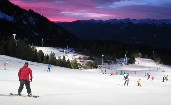
The latest snowfalls will allow the first resorts in the Pyrenees and the Cantabrian Mountains to open this week.
The arrival of a polar air mass has intensified northern and northwestern flows, bringing rain and snow to the Pyrenees and Cantabrian Mountains since Monday night. By 10 AM on Tuesday 25, snow depths continued to increase in high mountain areas, and the event remained fully active.
In the Pyrenees, this front has brought continuous snowfall, with significant accumulations in Val d’Aran, Alta Ribagorça, Andorra—with particular impact in Arcalís, Grau Roig, and Pas de la Casa—and in much of the French Pyrenees, where the areas of Aure, Hautes-Pyrénées, Couserans, and Capcir are experiencing notable effects.
The snow line has remained stable between 1,000 and 1,400 meters; in fact, it is snowing in Vielha (974 m) at this hour, an unusual phenomenon so early in the season. During the past night, the temperature drop associated with the Arctic air intrusion even allowed snow to fall intermittently below 1,000 meters.
Meanwhile, the Cantabrian Mountains are also fully experiencing the effects of this cold intrusion. According to AEMET, the day features very cloudy skies, reduced visibility in high areas, and moderate precipitation falling as snow from 1,200–1,400 meters. In mountain regions such as Camaleño or Cabrales, total accumulation could be around 30–35 l/m². This fully winter-like episode for the season will help consolidate the snowpack in Picos de Europa, Fuentes de Invierno, San Isidro, and Alto Campoo, which have seen continuous snowfall since last night.
The week will continue to be marked by a notable drop in temperatures and the presence of snow in wide areas of the northern Iberian Peninsula. According to weather forecasts, winter weather will persist until Friday, creating favorable conditions for the start of the ski season.
Between Tuesday and Wednesday, the Pyrenees will record moderate snowfall, especially abundant on its northern slope. The Cantabrian Mountains will also experience intermittent snow episodes. The weather will be rigorously cold, with very low minimums in high mountain areas and strong wind gusts on passes and summits, increasing the wind chill.
On Thursday, a new humid pulse from the northwest will arrive, reinforcing precipitation. Locally intense snowfalls are expected in the French Pyrenees and Andorra, with a snow line fluctuating between 1,100 and 1,300 meters, favoring accumulation in mid and high areas.
Toward Friday, the storm will tend to subside, although the cold will persist, and residual snowfall is not ruled out. From the weekend, the weather will show a progressive improvement, bringing an end to an episode marked by atmospheric instability.
This dynamic November is contributing to establishing the first favorable conditions for the start of the ski season, which could open earlier if the trend of cold and snow continues in the coming days.