%20--%3e%3cdefs%3e%3cstyle%3e%20.st0%20{%20fill:%20%231d1d1b;%20}%20%3c/style%3e%3c/defs%3e%3cpath%20class='st0'%20d='M174.5,69.9c-2.1-4.9-5.6-10.7-10.4-17.3-4.9-6.6-11-13.3-18.2-20-8.3-8.3-17.9-14.7-28.8-19-10.9-4.4-21.9-6.6-33-6.6s-23.7,2.7-33,8.1c-6.4,4.4-11.6,10.3-15.1,17.7-3.7,7.3-5.4,15.2-5.4,23.6,0,32.9,22.7,53.8,68,62.6,35.6,7,60.4,17.4,74.7,31.3,14.2,13.9,20.5,32.9,18.7,57-1.3,25.5-10.7,44.2-28.2,56.3-17.4,12.2-38.5,18.4-62.8,18.7-20-.2-38.3-3-55.2-8.1-16.9-5.2-31.2-12.6-43.1-22.1l-1.1-67.7c7.2,22.8,19.5,42,36.8,57.6,17.2,15.6,36.3,25.6,57.3,29.9,7.6,1.6,14.8,2.3,21.8,2.3,17.1,0,31.1-4.2,42.2-12.7,11-8.4,16.6-21.2,16.6-38.3s-6.4-30.7-19.5-43c-13-12.3-36.5-22.2-70.4-29.8-29.3-6.4-49.3-16.2-60.1-29.3-10.8-13.1-15.9-29.1-15.3-48,.2-14,4.2-26.3,12-37.1s18.4-19.2,31.9-25.2c13.4-6.1,28.8-9.1,45.9-9.1s28.2,1.9,41,5.7c12.8,3.8,23.7,8.3,32.5,13.8l.8,49h-.3Z'/%3e%3cpath%20class='st0'%20d='M269.3,250c0,11.1,3.7,18.4,10.9,22,7.2,3.4,14,5.2,20.2,5.2h-90.2c6.2,0,12.9-1.8,20-5.2,7.1-3.4,10.7-10.8,10.7-22V32.1c0-11.1-3.4-18.4-10.4-22-7-3.4-13.8-5.2-20.2-5.2h90.2c-6.4,0-13.3,1.8-20.5,5.2s-10.7,10.8-10.7,22v217.7h0ZM403.9,236.7c8.8,11.4,17.7,20.5,26.7,27.2,8.9,6.8,16.8,11.2,23.6,13.6l-53.7-.8c-9.1-8.3-18.2-18.6-27.6-30.7l-73.1-94.9c-2.3-3.1-5.3-4.7-8.9-4.7-6,0-12.4,3.7-19.5,10.9l90.6-108.5c5.7-6.8,8.6-13.4,8.6-20.2s-2-11.1-6-15.3-9.2-6.9-15.8-8h80.5c-2.3,0-7.6,1.7-15.8,5-8.1,3.3-17.7,9.9-28.6,19.5-4.9,4.4-13.1,13.6-24.7,27.6-11.6,14-21.6,26.3-30.1,36.9l-6.2,7.8c-5.7,5.7-8.6,11.1-8.6,16.3s1.9,8.4,5.8,13.6l82.8,104.6v.2Z'/%3e%3cpath%20class='st0'%20d='M516.2,248.4c0,11.7,3.7,19.3,11.1,23.1,7.3,3.8,14.3,5.7,20.8,5.7h-91.4c6.4,0,13.3-1.9,20.6-5.7s10.9-11.4,10.9-23.1V33.7c0-11.9-3.7-19.7-10.9-23.3s-14.1-5.4-20.6-5.4h91.4c-6.4,0-13.4,1.8-20.8,5.4-7.3,3.7-11.1,11.4-11.1,23.3v214.6h0Z'/%3e%3cpath%20class='st0'%20d='M770.2,243.3c4.9,13,10.8,21.7,17.4,26.2,6.8,4.6,12.7,7.1,17.9,7.6h-88.2c6.8-.8,12.4-2.9,17.1-6.2s7-8.1,7-14.3-.8-7.6-2.3-11.7l-28.8-80.9h-91l-25.7,70c-2.9,7.2-4.2,13.6-4.2,19,0,14.6,9.7,22.6,29.1,24.1h-72.4c8.8-.6,16.9-4.7,24.3-12.4,7.3-7.8,13.8-18.9,19.2-33.5L678-3.2l1.1,3.4,91,243.1ZM658.7,59.8c-1.9,4.4-4.6,11-8,19.8l-29.6,80.5h87.5l-30.7-87.5c-2.9-7.8-5.2-13-7.2-15.6-1.9-2.6-3.8-3.9-5.7-3.9s-4.4,2.2-6.4,6.6h.1Z'/%3e%3cpath%20class='st0'%20d='M1008.6,243.3c4.9,13,10.8,21.7,17.4,26.2,6.8,4.6,12.7,7.1,17.9,7.6h-88.2c6.8-.8,12.4-2.9,17.1-6.2s7-8.1,7-14.3-.8-7.6-2.3-11.7l-28.8-80.9h-91l-25.7,70c-2.9,7.2-4.2,13.6-4.2,19,0,14.6,9.7,22.6,29.1,24.1h-72.4c8.8-.6,16.9-4.7,24.3-12.4,7.3-7.8,13.8-18.9,19.2-33.5L916.3-3.2l1.1,3.4,91,243.1h.1ZM897.1,59.8c-1.9,4.4-4.6,11-8,19.8l-29.6,80.5h87.5l-30.7-87.5c-2.9-7.8-5.2-13-7.2-15.6-1.9-2.6-3.8-3.9-5.7-3.9s-4.4,2.2-6.4,6.6h.1Z'/%3e%3cpath%20class='st0'%20d='M1241.1,244.5c4.9,8.6,11,15.6,18.1,21s14.1,9.3,20.8,11.7h-47.8c-8-8-16.9-20.8-26.5-38.1l-37.3-63c-7.6-12.7-15.7-21-24.3-24.9s-19.6-5.8-32.5-5.8h-12.4v107.7c0,9.9,3.3,16.3,9.9,19.5s12.9,4.7,18.9,4.7h-87.9c6.4,0,13.2-1.8,20.2-5.2s10.4-10.8,10.4-22V32.1c0-11.1-3.6-18.4-10.7-22-7.1-3.4-13.8-5.2-20-5.2,10.3,0,25.5-.2,45.1-.8l37.7-.3c29,0,51.5,2.1,67.2,6.4,15.8,4.2,27.5,12.9,35,25.9,6.2,9.9,9.3,21.9,9.3,36.1s-2.4,22.2-7.3,32.5c-4.9,10.2-11.7,18.4-20.2,24.7-5.4,3.9-11.7,7.2-18.7,9.9s-13.4,4.3-19.5,4.9c4.7,1.3,9.6,4.2,14.8,8.9,5.2,4.7,11.1,13,17.9,24.9l39.7,66.5h0ZM1187.6,120.5c12.3-12.2,18.4-28.1,18.4-47.8s-7.4-42-22.3-51.6c-14.9-9.4-36.7-14.2-65.1-14.2s-15,.1-19.5.3v134.1c9.3,0,21.6-.2,36.6-.8,22.3-1.3,39.6-8,51.9-20.2h0Z'/%3e%3c/svg%3e)


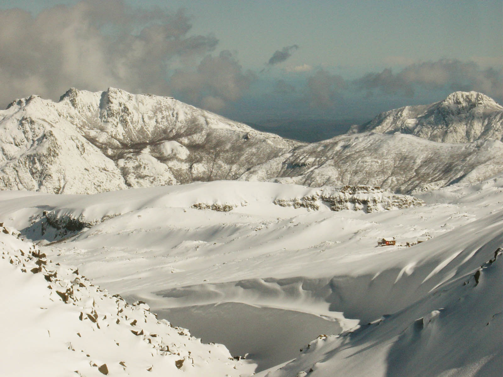
Epic snowfalls between Thursday and Saturday promise the best ski weekend in the central Andes.
An intense winter storm arrives this week in the Andes Mountain Range in Chile, promising exceptional conditions for the country's central ski resorts. According to the latest report, 38 to 50 cm of light powder snow are expected, especially between Thursday night and Saturday, thanks to a double pulse of precipitation combining Pacific moisture with cold Antarctic air.
A Storm Divided into Two Acts
The first front, warmer and wetter, will impact southern volcanoes like Nevados de Chillán and Corralco on Wednesday night and Thursday (July 30–31), leaving dense "cream cheese" snow. This phase will bring gusts exceeding 70 km/h and low snow-to-liquid ratios (SLR) (between 3:1 and 6:1), which could affect surface snow quality.
However, starting Thursday night, the pattern changes radically. A second, colder and drier front drags Antarctic air over the central Andes, lowering snow levels from 2,400 to 1,300 meters, and raising SLRs to optimal values (14:1 to 17:1). This means drier, lighter snow, excellent for skiers seeking speed and flotation.
The Epicenter: Central Andes
Among the main beneficiaries are Valle Nevado, La Parva, El Colorado, and Portillo, where snowfall is expected to reach between 40 and 50 cm of powder snow from Thursday night until Saturday morning. Temperatures will drop to -8 °C, with moderate winds and gentle but consistent accumulations during both nights.
Friday (August 1) will be the key day: 20 to 30 cm of new snow are expected with ideal skiing conditions, including ultralight snow, manageable wind, and plummeting temperatures. On Saturday, a new overnight refresh of up to 40 cm will consolidate the best weekend of the season for riders from Santiago and its surroundings.
Chillán: From Humidity to Glory
In Nevados de Chillán, the story will be different but equally exciting. Although Wednesday night and Thursday bring heavy snow (up to 50 cm in total), colder air arrives on Friday night, allowing a transformation to drier powder. If crowds congest the resorts near Santiago, Chillán could become a secret gem on Saturday, with good visibility, fewer crowds, and trees providing wind protection.
Patagonia and the Far South: Minor Snowfall
Further south, northern Patagonia ski resorts like Catedral and Chapelco will see modest accumulations (3–8 cm daily), with intermittent snowfall until Sunday. Las Leñas in Mendoza will receive between 15 and 30 cm total, although coverage will remain limited. Cerro Castor, in Tierra del Fuego, will barely reach 2–4 cm between Wednesday and Thursday.