%20--%3e%3cdefs%3e%3cstyle%3e%20.st0%20{%20fill:%20%231d1d1b;%20}%20%3c/style%3e%3c/defs%3e%3cpath%20class='st0'%20d='M174.5,69.9c-2.1-4.9-5.6-10.7-10.4-17.3-4.9-6.6-11-13.3-18.2-20-8.3-8.3-17.9-14.7-28.8-19-10.9-4.4-21.9-6.6-33-6.6s-23.7,2.7-33,8.1c-6.4,4.4-11.6,10.3-15.1,17.7-3.7,7.3-5.4,15.2-5.4,23.6,0,32.9,22.7,53.8,68,62.6,35.6,7,60.4,17.4,74.7,31.3,14.2,13.9,20.5,32.9,18.7,57-1.3,25.5-10.7,44.2-28.2,56.3-17.4,12.2-38.5,18.4-62.8,18.7-20-.2-38.3-3-55.2-8.1-16.9-5.2-31.2-12.6-43.1-22.1l-1.1-67.7c7.2,22.8,19.5,42,36.8,57.6,17.2,15.6,36.3,25.6,57.3,29.9,7.6,1.6,14.8,2.3,21.8,2.3,17.1,0,31.1-4.2,42.2-12.7,11-8.4,16.6-21.2,16.6-38.3s-6.4-30.7-19.5-43c-13-12.3-36.5-22.2-70.4-29.8-29.3-6.4-49.3-16.2-60.1-29.3-10.8-13.1-15.9-29.1-15.3-48,.2-14,4.2-26.3,12-37.1s18.4-19.2,31.9-25.2c13.4-6.1,28.8-9.1,45.9-9.1s28.2,1.9,41,5.7c12.8,3.8,23.7,8.3,32.5,13.8l.8,49h-.3Z'/%3e%3cpath%20class='st0'%20d='M269.3,250c0,11.1,3.7,18.4,10.9,22,7.2,3.4,14,5.2,20.2,5.2h-90.2c6.2,0,12.9-1.8,20-5.2,7.1-3.4,10.7-10.8,10.7-22V32.1c0-11.1-3.4-18.4-10.4-22-7-3.4-13.8-5.2-20.2-5.2h90.2c-6.4,0-13.3,1.8-20.5,5.2s-10.7,10.8-10.7,22v217.7h0ZM403.9,236.7c8.8,11.4,17.7,20.5,26.7,27.2,8.9,6.8,16.8,11.2,23.6,13.6l-53.7-.8c-9.1-8.3-18.2-18.6-27.6-30.7l-73.1-94.9c-2.3-3.1-5.3-4.7-8.9-4.7-6,0-12.4,3.7-19.5,10.9l90.6-108.5c5.7-6.8,8.6-13.4,8.6-20.2s-2-11.1-6-15.3-9.2-6.9-15.8-8h80.5c-2.3,0-7.6,1.7-15.8,5-8.1,3.3-17.7,9.9-28.6,19.5-4.9,4.4-13.1,13.6-24.7,27.6-11.6,14-21.6,26.3-30.1,36.9l-6.2,7.8c-5.7,5.7-8.6,11.1-8.6,16.3s1.9,8.4,5.8,13.6l82.8,104.6v.2Z'/%3e%3cpath%20class='st0'%20d='M516.2,248.4c0,11.7,3.7,19.3,11.1,23.1,7.3,3.8,14.3,5.7,20.8,5.7h-91.4c6.4,0,13.3-1.9,20.6-5.7s10.9-11.4,10.9-23.1V33.7c0-11.9-3.7-19.7-10.9-23.3s-14.1-5.4-20.6-5.4h91.4c-6.4,0-13.4,1.8-20.8,5.4-7.3,3.7-11.1,11.4-11.1,23.3v214.6h0Z'/%3e%3cpath%20class='st0'%20d='M770.2,243.3c4.9,13,10.8,21.7,17.4,26.2,6.8,4.6,12.7,7.1,17.9,7.6h-88.2c6.8-.8,12.4-2.9,17.1-6.2s7-8.1,7-14.3-.8-7.6-2.3-11.7l-28.8-80.9h-91l-25.7,70c-2.9,7.2-4.2,13.6-4.2,19,0,14.6,9.7,22.6,29.1,24.1h-72.4c8.8-.6,16.9-4.7,24.3-12.4,7.3-7.8,13.8-18.9,19.2-33.5L678-3.2l1.1,3.4,91,243.1ZM658.7,59.8c-1.9,4.4-4.6,11-8,19.8l-29.6,80.5h87.5l-30.7-87.5c-2.9-7.8-5.2-13-7.2-15.6-1.9-2.6-3.8-3.9-5.7-3.9s-4.4,2.2-6.4,6.6h.1Z'/%3e%3cpath%20class='st0'%20d='M1008.6,243.3c4.9,13,10.8,21.7,17.4,26.2,6.8,4.6,12.7,7.1,17.9,7.6h-88.2c6.8-.8,12.4-2.9,17.1-6.2s7-8.1,7-14.3-.8-7.6-2.3-11.7l-28.8-80.9h-91l-25.7,70c-2.9,7.2-4.2,13.6-4.2,19,0,14.6,9.7,22.6,29.1,24.1h-72.4c8.8-.6,16.9-4.7,24.3-12.4,7.3-7.8,13.8-18.9,19.2-33.5L916.3-3.2l1.1,3.4,91,243.1h.1ZM897.1,59.8c-1.9,4.4-4.6,11-8,19.8l-29.6,80.5h87.5l-30.7-87.5c-2.9-7.8-5.2-13-7.2-15.6-1.9-2.6-3.8-3.9-5.7-3.9s-4.4,2.2-6.4,6.6h.1Z'/%3e%3cpath%20class='st0'%20d='M1241.1,244.5c4.9,8.6,11,15.6,18.1,21s14.1,9.3,20.8,11.7h-47.8c-8-8-16.9-20.8-26.5-38.1l-37.3-63c-7.6-12.7-15.7-21-24.3-24.9s-19.6-5.8-32.5-5.8h-12.4v107.7c0,9.9,3.3,16.3,9.9,19.5s12.9,4.7,18.9,4.7h-87.9c6.4,0,13.2-1.8,20.2-5.2s10.4-10.8,10.4-22V32.1c0-11.1-3.6-18.4-10.7-22-7.1-3.4-13.8-5.2-20-5.2,10.3,0,25.5-.2,45.1-.8l37.7-.3c29,0,51.5,2.1,67.2,6.4,15.8,4.2,27.5,12.9,35,25.9,6.2,9.9,9.3,21.9,9.3,36.1s-2.4,22.2-7.3,32.5c-4.9,10.2-11.7,18.4-20.2,24.7-5.4,3.9-11.7,7.2-18.7,9.9s-13.4,4.3-19.5,4.9c4.7,1.3,9.6,4.2,14.8,8.9,5.2,4.7,11.1,13,17.9,24.9l39.7,66.5h0ZM1187.6,120.5c12.3-12.2,18.4-28.1,18.4-47.8s-7.4-42-22.3-51.6c-14.9-9.4-36.7-14.2-65.1-14.2s-15,.1-19.5.3v134.1c9.3,0,21.6-.2,36.6-.8,22.3-1.3,39.6-8,51.9-20.2h0Z'/%3e%3c/svg%3e)
The AEMET warns that it is advisable to prepare for the upcoming weather during the long weekend: a full winter storm will affect a large part of Spain, bringing snowfalls from about 1,000 meters and a distinctly wintry atmosphere in numerous areas of the country.
Today, Friday, December 5, the State Meteorological Agency (AEMET) maintains several active warnings due to the coincidence of three adverse phenomena that could complicate travel at the beginning of the long weekend: strong winds, coastal storms in various areas, and snow in mountain regions.
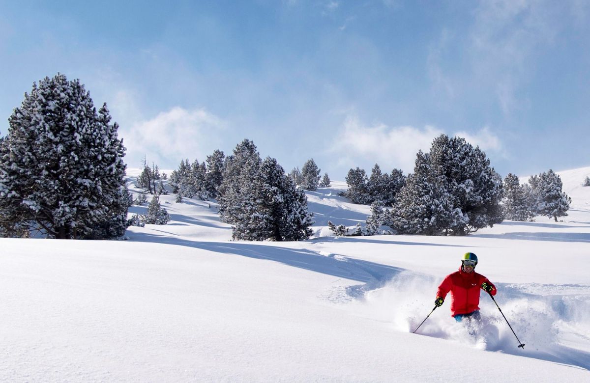
Although a widespread snow event is not expected, problems are anticipated on various mountain roads over the coming days. AEMET maintains snow warnings for the Huesca Pyrenees, the Valle de Arán (Lleida), the Navarre Pyrenees, the Cantabrian Mountains in León, and the Serranía de Cuenca.
In these areas, up to 5 centimeters of snow could accumulate in 24 hours, even reaching 15 centimeters in the Leonese Cantabrian Mountains, with a snow line situated between 1,000 and 1,200 meters.
Snow could also appear, though more sporadically, in elevated areas of the Sistema Central and the northern plateau, related to the passage of the cold front crossing the Peninsula.
Throughout today, a change in weather patterns will occur. Snowfall will continue in the Western Pyrenees in the morning, but the influx of warmer air will cause a rapid rise in the snow line, moving from about 1,200 meters to 1,900–2,000 meters by the end of the day. This thermal rise could bring rain to mid-elevations, deteriorating the quality of the freshly fallen snow. Nevertheless, the snow accumulated from this Thursday will maintain a consistent base, although it will become wetter and heavier due to liquid precipitation.
In the rest of the northern and central Peninsular mountain ranges, precipitation will be weaker and more scattered, tending to subside as hours pass. The rise in temperatures will thus mark the end of this brief winter episode.