%20--%3e%3cdefs%3e%3cstyle%3e%20.st0%20{%20fill:%20%231d1d1b;%20}%20%3c/style%3e%3c/defs%3e%3cpath%20class='st0'%20d='M174.5,69.9c-2.1-4.9-5.6-10.7-10.4-17.3-4.9-6.6-11-13.3-18.2-20-8.3-8.3-17.9-14.7-28.8-19-10.9-4.4-21.9-6.6-33-6.6s-23.7,2.7-33,8.1c-6.4,4.4-11.6,10.3-15.1,17.7-3.7,7.3-5.4,15.2-5.4,23.6,0,32.9,22.7,53.8,68,62.6,35.6,7,60.4,17.4,74.7,31.3,14.2,13.9,20.5,32.9,18.7,57-1.3,25.5-10.7,44.2-28.2,56.3-17.4,12.2-38.5,18.4-62.8,18.7-20-.2-38.3-3-55.2-8.1-16.9-5.2-31.2-12.6-43.1-22.1l-1.1-67.7c7.2,22.8,19.5,42,36.8,57.6,17.2,15.6,36.3,25.6,57.3,29.9,7.6,1.6,14.8,2.3,21.8,2.3,17.1,0,31.1-4.2,42.2-12.7,11-8.4,16.6-21.2,16.6-38.3s-6.4-30.7-19.5-43c-13-12.3-36.5-22.2-70.4-29.8-29.3-6.4-49.3-16.2-60.1-29.3-10.8-13.1-15.9-29.1-15.3-48,.2-14,4.2-26.3,12-37.1s18.4-19.2,31.9-25.2c13.4-6.1,28.8-9.1,45.9-9.1s28.2,1.9,41,5.7c12.8,3.8,23.7,8.3,32.5,13.8l.8,49h-.3Z'/%3e%3cpath%20class='st0'%20d='M269.3,250c0,11.1,3.7,18.4,10.9,22,7.2,3.4,14,5.2,20.2,5.2h-90.2c6.2,0,12.9-1.8,20-5.2,7.1-3.4,10.7-10.8,10.7-22V32.1c0-11.1-3.4-18.4-10.4-22-7-3.4-13.8-5.2-20.2-5.2h90.2c-6.4,0-13.3,1.8-20.5,5.2s-10.7,10.8-10.7,22v217.7h0ZM403.9,236.7c8.8,11.4,17.7,20.5,26.7,27.2,8.9,6.8,16.8,11.2,23.6,13.6l-53.7-.8c-9.1-8.3-18.2-18.6-27.6-30.7l-73.1-94.9c-2.3-3.1-5.3-4.7-8.9-4.7-6,0-12.4,3.7-19.5,10.9l90.6-108.5c5.7-6.8,8.6-13.4,8.6-20.2s-2-11.1-6-15.3-9.2-6.9-15.8-8h80.5c-2.3,0-7.6,1.7-15.8,5-8.1,3.3-17.7,9.9-28.6,19.5-4.9,4.4-13.1,13.6-24.7,27.6-11.6,14-21.6,26.3-30.1,36.9l-6.2,7.8c-5.7,5.7-8.6,11.1-8.6,16.3s1.9,8.4,5.8,13.6l82.8,104.6v.2Z'/%3e%3cpath%20class='st0'%20d='M516.2,248.4c0,11.7,3.7,19.3,11.1,23.1,7.3,3.8,14.3,5.7,20.8,5.7h-91.4c6.4,0,13.3-1.9,20.6-5.7s10.9-11.4,10.9-23.1V33.7c0-11.9-3.7-19.7-10.9-23.3s-14.1-5.4-20.6-5.4h91.4c-6.4,0-13.4,1.8-20.8,5.4-7.3,3.7-11.1,11.4-11.1,23.3v214.6h0Z'/%3e%3cpath%20class='st0'%20d='M770.2,243.3c4.9,13,10.8,21.7,17.4,26.2,6.8,4.6,12.7,7.1,17.9,7.6h-88.2c6.8-.8,12.4-2.9,17.1-6.2s7-8.1,7-14.3-.8-7.6-2.3-11.7l-28.8-80.9h-91l-25.7,70c-2.9,7.2-4.2,13.6-4.2,19,0,14.6,9.7,22.6,29.1,24.1h-72.4c8.8-.6,16.9-4.7,24.3-12.4,7.3-7.8,13.8-18.9,19.2-33.5L678-3.2l1.1,3.4,91,243.1ZM658.7,59.8c-1.9,4.4-4.6,11-8,19.8l-29.6,80.5h87.5l-30.7-87.5c-2.9-7.8-5.2-13-7.2-15.6-1.9-2.6-3.8-3.9-5.7-3.9s-4.4,2.2-6.4,6.6h.1Z'/%3e%3cpath%20class='st0'%20d='M1008.6,243.3c4.9,13,10.8,21.7,17.4,26.2,6.8,4.6,12.7,7.1,17.9,7.6h-88.2c6.8-.8,12.4-2.9,17.1-6.2s7-8.1,7-14.3-.8-7.6-2.3-11.7l-28.8-80.9h-91l-25.7,70c-2.9,7.2-4.2,13.6-4.2,19,0,14.6,9.7,22.6,29.1,24.1h-72.4c8.8-.6,16.9-4.7,24.3-12.4,7.3-7.8,13.8-18.9,19.2-33.5L916.3-3.2l1.1,3.4,91,243.1h.1ZM897.1,59.8c-1.9,4.4-4.6,11-8,19.8l-29.6,80.5h87.5l-30.7-87.5c-2.9-7.8-5.2-13-7.2-15.6-1.9-2.6-3.8-3.9-5.7-3.9s-4.4,2.2-6.4,6.6h.1Z'/%3e%3cpath%20class='st0'%20d='M1241.1,244.5c4.9,8.6,11,15.6,18.1,21s14.1,9.3,20.8,11.7h-47.8c-8-8-16.9-20.8-26.5-38.1l-37.3-63c-7.6-12.7-15.7-21-24.3-24.9s-19.6-5.8-32.5-5.8h-12.4v107.7c0,9.9,3.3,16.3,9.9,19.5s12.9,4.7,18.9,4.7h-87.9c6.4,0,13.2-1.8,20.2-5.2s10.4-10.8,10.4-22V32.1c0-11.1-3.6-18.4-10.7-22-7.1-3.4-13.8-5.2-20-5.2,10.3,0,25.5-.2,45.1-.8l37.7-.3c29,0,51.5,2.1,67.2,6.4,15.8,4.2,27.5,12.9,35,25.9,6.2,9.9,9.3,21.9,9.3,36.1s-2.4,22.2-7.3,32.5c-4.9,10.2-11.7,18.4-20.2,24.7-5.4,3.9-11.7,7.2-18.7,9.9s-13.4,4.3-19.5,4.9c4.7,1.3,9.6,4.2,14.8,8.9,5.2,4.7,11.1,13,17.9,24.9l39.7,66.5h0ZM1187.6,120.5c12.3-12.2,18.4-28.1,18.4-47.8s-7.4-42-22.3-51.6c-14.9-9.4-36.7-14.2-65.1-14.2s-15,.1-19.5.3v134.1c9.3,0,21.6-.2,36.6-.8,22.3-1.3,39.6-8,51.9-20.2h0Z'/%3e%3c/svg%3e)
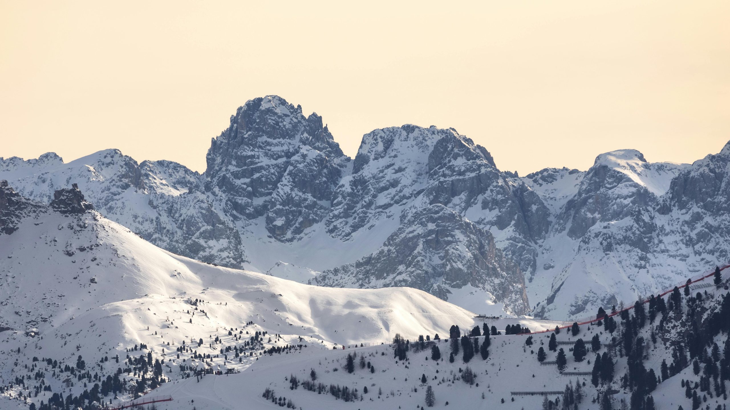
The polar pulse is already leaving record snowfalls in Chile and Argentina, with accumulations of up to 2.2 meters in the mountains.
A mass of frigid air is advancing from the south of the continent, threatening to transform the landscape of the Andes and Patagonia. This is a polar pulse, an irruption of extreme cold that, until August 3, could generate one of the most intense snowfalls in recent years.
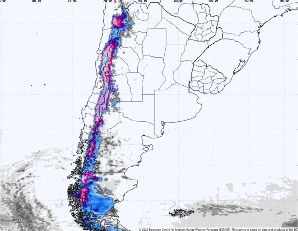
In Chile, ski resorts like Nevados de Chillán could accumulate over 2 meters of snow, while in Valle Nevado, El Colorado, and La Parva, figures would range between 66 centimeters and 1.15 meters. On the Argentine side, 30 to 50 centimeters are expected in the Patagonian mountain range, and up to 20 centimeters in plateau sectors and flat areas.
What is a polar pulse?
It is a phenomenon that occurs when a mass of very cold air, originating from latitudes near Antarctica, moves towards more temperate regions. This movement is usually accompanied by low-pressure systems and humid winds which, when interacting, create the ideal environment for heavy snowfalls.
In this case, the cold air began to be felt on July 28 in Tierra del Fuego and Santa Cruz, and is advancing northward, reaching areas such as Cuyo, the west of the Pampas region, and even part of Buenos Aires, with cold rains and drizzles.
Where it will snow and how much is expected
- Nevados de Chillán: between 1.35 and 2.24 meters of snow
- Valle Nevado, La Parva, and El Colorado: between 66 cm and 1.15 m
- Argentine Patagonian mountain range: between 30 and 50 cm
- Patagonian plateau and southern flat areas: between 10 and 20 cm
- South-central Mendoza: up to 40 cm
Cities like Bariloche, Esquel, San Martín de los Andes, and Comodoro Rivadavia could be covered by snow and face days with minimum temperatures below -15°C.
What’s next
The forecast includes intense snowfalls until Monday, August 4. Maximum temperatures will remain below 0°C in many areas. Road closures, power outages, and difficult driving conditions are expected.
The National Meteorological Service does not rule out that a new polar air mass will arrive in the following days, prolonging the effects of the phenomenon.